About Us
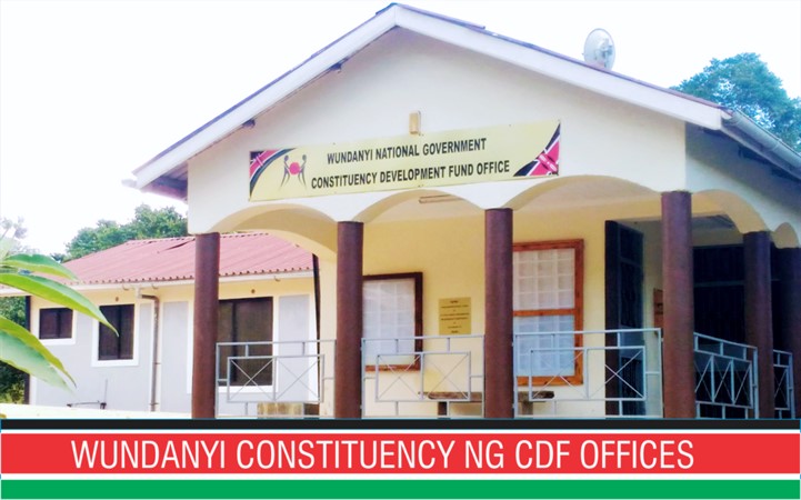
Wundanyi Constituency
About Wundanyi Constituency
Wundanyi Constituency is one of the four constituencies that make up Taita-Taveta County.
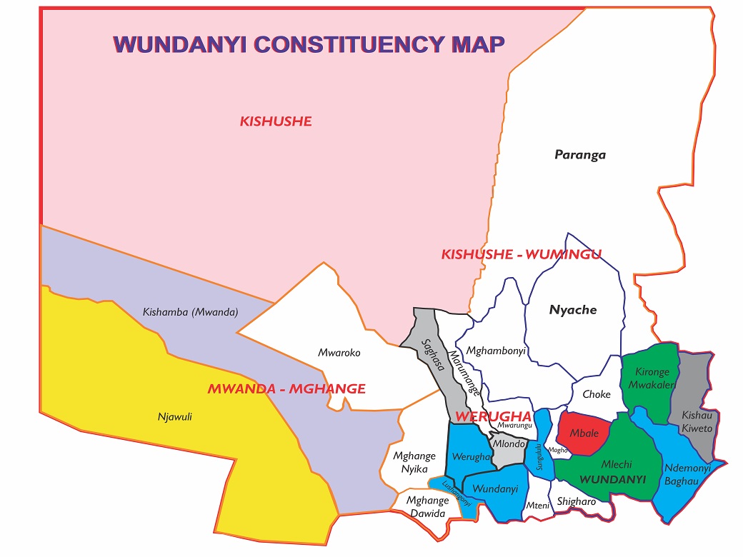
The constituency is divided into four administrative wards namely:
Wundanyi/Mbale,
Werugha,
Wumingu/Kishushe
Mghange/Mwanda.
It has seven locations namely; Werugha, Wundanyi, Mbale, Kishushe, Wumingu, Mghange and Mwanda.
The constituency has an estimated population of 58,600 residents.
Wundanyi Constituency is one of the four constituencies of Taita Taveta County. It lies approximately 40km from Voi town and borders Mwatate, Voi and Taveta constituencies.
Wundanyi Constituency is segmented into two zones: The upper zone of Taita Hills and the lowlands of Kishushe and Paranga. The Taita Hills are considerably wet, covering an approximate area of 1,000 Km2, rise to a maximum elevation of 2,208 metres above sea level and experience relief rainfall. T
he hills experience two rainy seasons - the long rains between the months of March and May; and the short rains between October and December.
The highest point in Coast region with an altitude of 2,208 metres above sea level (Vuria Peak) is found in Wundanyi. Others are Iyale Hill, Ngangao Forest and Wesu Rock. The hills are home to the Taita Thrush, Taita Falcon and the Taita Apalis which are endemic bird species.
According to the Kenya National Bureau of Statistics (2011), Wundanyi constituency occupies
3,376.00 Square Kms.
The constituency is served by various road networks. Only about 6Km is bitumen class while
the rest are earth roads. The constituency has no railway line and no airstrip. The Wundanyi-
Mwatate road is the only tarmacked link to other constituencies.
According to KNBS (2009), Wundanyi Constituency had a population of 58,600 with an estimated 14,532 households and covers 3,376.00 Km2. The Taita Taveta County CIDP (2018/2022) projects that the population would rise to 64,469 by 2018. This represents a population density of 97.63 and sex ratio of 34,170 females to 34,299 males (1:1.003).
Economic activities in the contituency include crop farming, ranching, livestock keeping, mining, tourism and trading. The Kishushe region is generally flat and vast making it suitable for ranching. There has been an increase in dairy milk production in the constituency prompting the establishment of a milk cooling plant with an estimated capacity of preserving 30,000 litres per day. The plant has created employment both directly and indirectly and improved daily income forhouseholds through milk sales.
The Taita Hills are a source of water to the lower regions making them suitable for fish farming, although it has not been fully exploited. The weather conditions for Wundanyi make it possible for farmers to grow trees on their farms where they harvest forest products including timber, building poles, firewood and to some extent charcoal.
Access NG-CDF Information on your Mobile


County Assembly Wards in Wundanyi Constituency:
Wundanyi-Mbale Ward
- County Assembly Ward No.:
- County Assembly Ward Name: Wundanyi-Mbale
- County Assembly Ward Population (Approx.):
- County Assembly Ward Area In Sq. Km (Approx.):
- County Assembly Ward Description: comprises part of
Werugha Ward
- County Assembly Ward No.:
- County Assembly Ward Name: Werugha
- County Assembly Ward Population (Approx.):
- County Assembly Ward Area In Sq. Km (Approx.):
- County Assembly Ward Description: comprises part of
Mgange-Mwanda Ward
- County Assembly Ward No.:
- County Assembly Ward Name: Mgange-Mwanda
- County Assembly Ward Population (Approx.):
- County Assembly Ward Area In Sq. Km (Approx.):
- County Assembly Ward Description: comprises part of
Wumingu-Kishushe Ward
- County Assembly Ward No.:
- County Assembly Ward Name: Wumingu-Kishushe
- County Assembly Ward Population (Approx.):
- County Assembly Ward Area In Sq. Km (Approx.):
- County Assembly Ward Description: comprises part of